Hacienda, Russian River, Sonoma, California
HUMANS
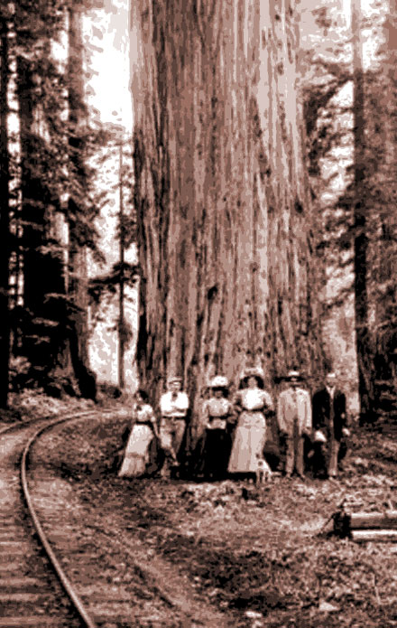
Humans with a tree. Three are male, and three are female. They appear to be of an age where they would be sexually active. A domesticated animal is also shown. The tree is the large object behind them. Though much older, it is also sexually active.
Some may question my decision to start my human story in 1852 suggesting that surely there were native humans here before then. My research suggests that Native Americans lived upstream and on the coast, but they considered the giant trees to be haunted and would rarely venture into them. They were wrong of course, the trees are not haunted. What they sensed was the redwood's overwhelming wisdom. To be confronted by the ancient is unnerving, like looking at the stars at night.
The humans that matter to this story are Mathew and Mary McPeak who loaded all their belongings into an oxcart and headed west from Missouri. Matthew's brother, Henry, died four years earlier so joining them was Henry's widow, Nancy, and their two sons. They, like others of the time, took the Platte River trail heading west to California. Hacienda's founding father was one of those kids. He was a precocious sixteen year old named Anthony. The family went though Placerville, California, thorough Central Valley, ending up four miles northwest of Santa Rosa. I would guess they were out near the Santa Rosa Creek. They brought their savings with them and were able to buy property.
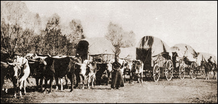
The trail was about 3,000 miles long and took most of 6 months to travel. California had only been a state for two years when the McPeak family made the trip in 1852.
THE MCPEAK WAGON
Matthew McPeak (56)
Mary McPeak (48)
- Mary (20)
- Sarah (18)
- Anthony (16)
- Matthew (13)
- Malinda (11)
Nancy McPeak (adult)
- Eugene (15)
- Peter (18)
As you can see, Anthony had a younger brother named Matthew. He was named after his father, Matthew. When Anthony had children, he named a son, Matthew after his father. Complicates research.
Anthony's big sister, Mary Ann.
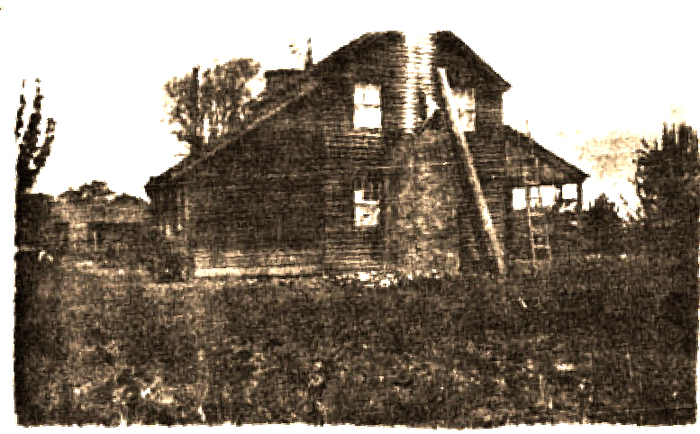
The McPeak homestead outside of Santa Rosa about 1856. Somewhere near this photo, a 20 year old Anthony McPeak is preparing to strike out on his own.
Anthony and his siblings loved to swim at the Russian River gravel bar near where the river was shallow enough to cross. The kids would climb onto the rocks nearby and jump. The river is shallow in many places but at the foot of that rock, it is over 20 feet deep.
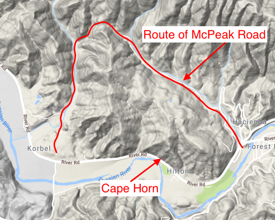
Often he would ride his horse west along Westside Road. He would follow a deer trail on the other side of the Ridenhour House that skirted a steep hill that dropped into the river to marvel at the beauty of the old growth redwoods. He envisioned a world where all those giant trees would be cut down and turned into lumber. So a few years later, when Anthony was 21 in 1857, he set out on his own. He purchased 160 acres of those redwoods west of the Ridenhour Ranch with plans to build a mill and process the trees into much needed lumber. He paid $1.25 an acre, $200 (about $5,500 in 2017.) I'm guessing he got the money from his father because some maps show the owner as A&M McPeak, probably Anthony and Mathew, his father (though Matthew was also the name of his brother.) That was a good price because the trees were isolated by that steep hill that went straight down to the river making it difficult to move lumber or cut trees from his property. A narrow road was carved into the hill, later to be known as "Cape Horn," and he was able to get to the property about a mile west of the Ridenhour House, but rain would create slides and he would have to rebuild the road past Cape Horn many times.
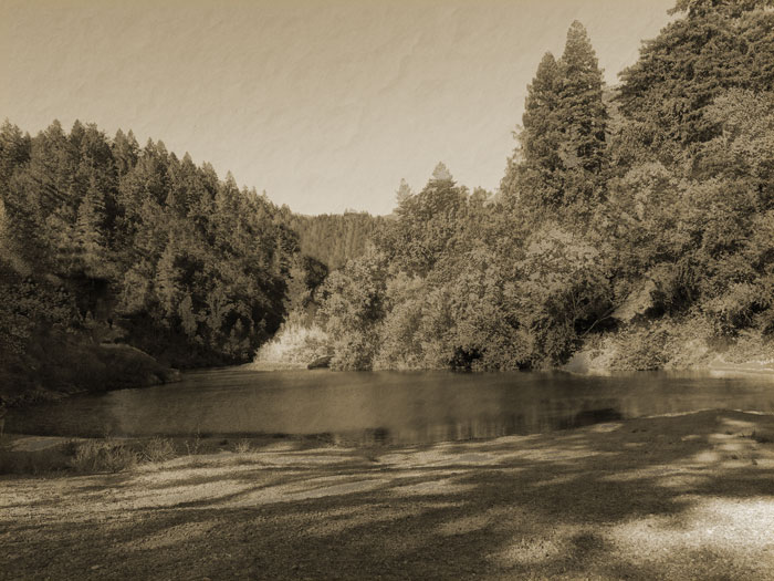
The McPeak kids liked to swim at the gravel bar near the Hobson's house. "Red" McGinnis nearly drowned here in 1927. Michael Hourigan died here in 2007 after jumping from the Hacienda Bridge.
Anthony worked that land really hard for the next fourteen years. On the other side of the country, the Civil War raged, but here life was simple. He married Mellisa Bell in Santa Rosa, fathered nine kids, (Lenora Florence*, Harmon*, Henry Edmond*, Minnie*, C. Wiley*, Matthew Lawrence*, Jerry Martin*, Pressley Paine* and Philip W*.) He was not able to gather the necessary funds to built the sawmill and harvest the redwoods on the property.
But then, in 1871, he got an offer from three San Francisco brothers, Francis, Anton, and Joseph Korbel. They wanted to buy his property. It was an offer he couldn't refuse so he didn't. They did have the funds to build a sawmill and they wanted those trees. With his earnings he was able to buy the 690 acre Hobson Farm two miles up the river in a valley formed where Hobson Creek flowed into the Russian River. Hobson Creek was named for early pioneer, A.D. Hobson who, with his wife and children, lived next to the creek that flowed onto the gravel bar. Anthony had known the family for many years. That relationship was the key to Anthony being able to buy the Hobson property. The fact that he now owned the very land that he had played on as a kid gave him and his family a sense of accomplishment and pride. The McPeaks either built a home near the creek, or moved into the old Hobson house (I figure the latter just considering the need for a home was a bit urgent.) The Hobsons moved to other property they owned across the river from Mirabel Park.
Anthony, at 35, had become well respected as an honest businessman, loving husband and father. With his good looks and outgoing personality, many thought he should enter politics. He only laughed and said he didn't think so.
For the McPeaks it was almost like starting over. For the Korbels on the former McPeak land, it was the beginning of a lumber and, in time, a wine and Champagne empire. The McPeaks and the Korbels were friendly. They built a road, Cosmo Road (later renamed McPeak Road,) that stretched from Westside Road around the hill into the back side of the Korbel property, thereby avoiding the difficult Cape Horn along the river. Korbel could haul lumber by oxcart from the mill, crossing the Russian River at the shallow place on the McPeak property to take their lumber to the railway, a journey that could take many days.
*Confirmed
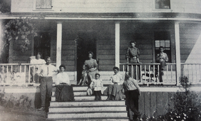
The McPeaks. I'm going to guess that to the right of the steps is Anthony and Mellisa. To the left is daughter, Minnie, and her husband, A.I. Meisner. Others I would guess are grandchildren and Cosmo Farm staff.
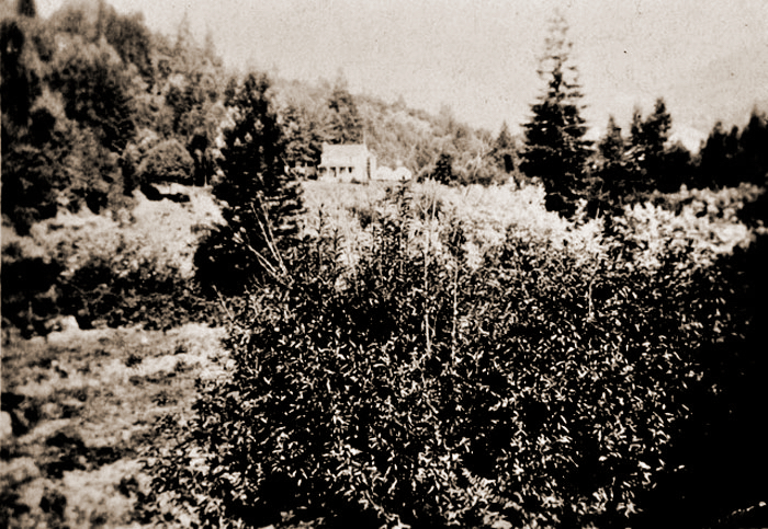
The McPeak home was visible coming down Westside Road from Healdsburg.
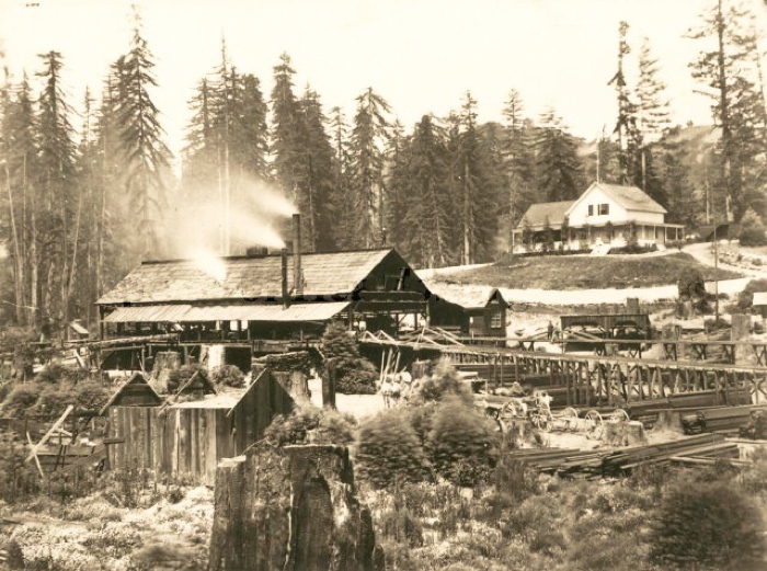
The Korbel Saw Mill on the former McPeak property after the arrival of the railroad. The mill location is currently the parking lot for the winery. The Korbel house in the background is still there, though unoccupied in 2017.
The McPeaks cleared land and started raising sheep. He became the largest sheep rancher in the area having 800 head of sheep. He also farmed, growing hops for the making of beer, grapes for wine, and fruit of all kinds. His apricot orchards were widely known for their excellent fruit.
His property was getting a reputation as a good place to camp, to use the gravel bar as a place to swim. People would take canoes down the river from Healdsburg or ride horses down the dirt road called Westside. The McPeaks always extended hospitality to those passing through. Anthony and Melissa had an idea. As more and more people wanted to stay on the property, they could charge people to camp on the property and provide them with basic needs, like food. They built platforms for tents and a dining room to offer the campers delicious home cooking. The new enterprise, Cosmo Farm, was an instant success.
The farm was named for the abundance of beautiful cosmos that grew on the property.
It would be very easy just to move on but I am going to ponder Cosmo Farm for a moment. Russian River was a barrier with no bridges. The only way to get to Cosmo Farm was by boat, or riding a horse along the 14 mile dirt road from urban Healdsburg. Healdsburg's population was about 1,700 people. One could perhaps, depending on the water level, come from Forestville and cross through the river at a shallow point. And once at Cosmo Farm, taking Westside Road further west would get you to a small community which would organize into Hilton later, and by squeezing by Cape Horn you could get another mile to Korbel's Mill. There was nothing beyond that. The road didn't go further. Guerneville existed but steep cliffs blocked access to that section of the river. Rio Nido, known as Eagle's Nest, did not exist except as a forest of trees waiting to be milled.